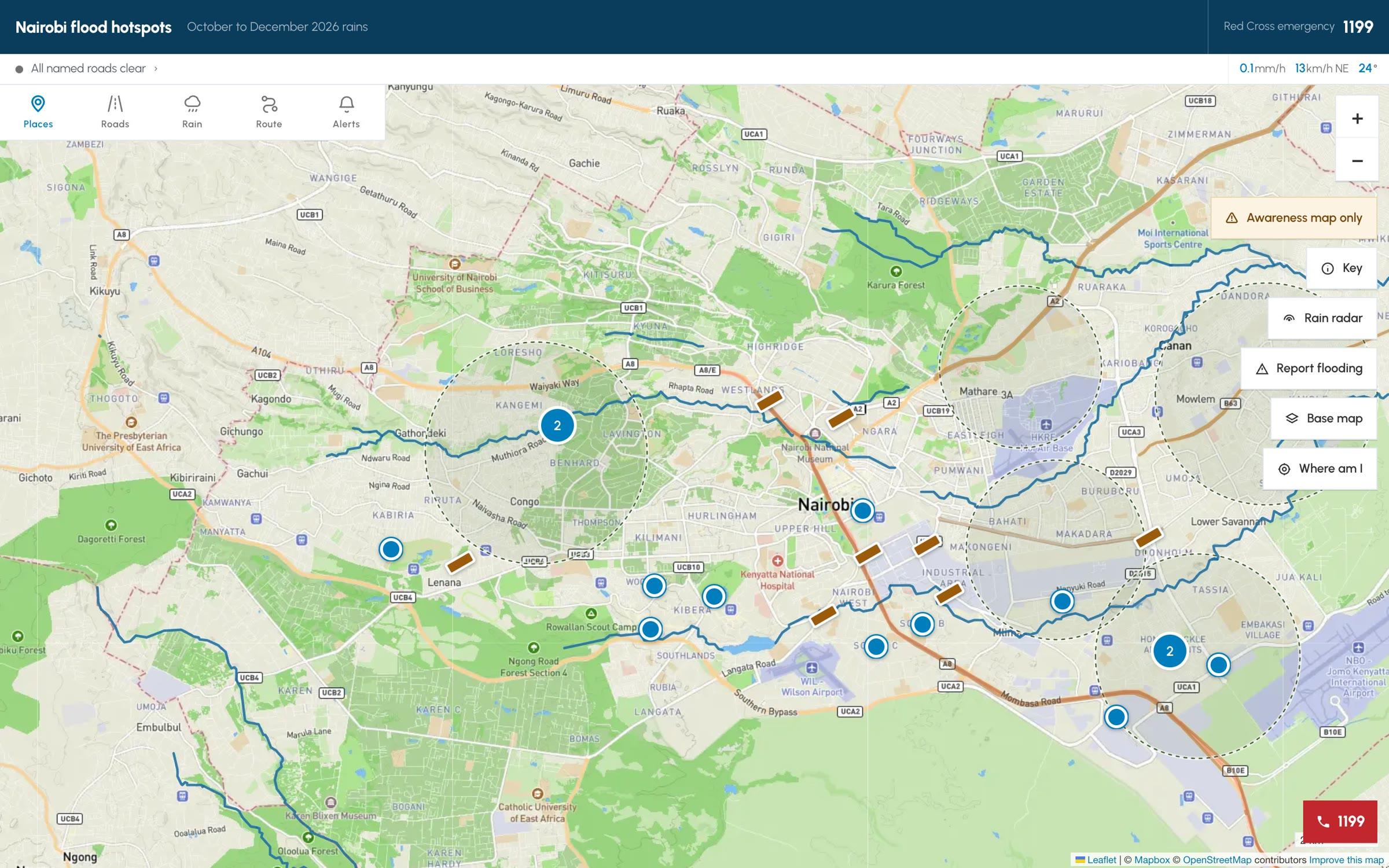
Mafuriko puts Nairobi's reported flood hotspots, rainfall and road closures on one map, free, on any phone. It is built for residents, not analysts: anyone can check their area or report flooding in a few taps.
- Report flooding. A short form with location, what is happening and an optional photo. Reports wait for verification.
- Check your area. Search a place to see nearby hotspots, rainfall and affected roads, with layers you can switch on and off.
Mafuriko is an awareness map, not a forecast. AIVERSE, our AI practice, powers the AI and data behind it.